
A History of 5 Years.
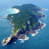
A island it is opposite Pontal do Campeche, being considered the most important archaeological site in Florianópolis. A mystical place, where primitive men lived about 5 thousand years ago, leaving as a great legacy the largest concentration of rock inscriptions in Santa Catarina.
Even having some inscriptions dynamited by naive treasure hunters in the past, the signs on the walls of diabase, are still visible in the western part of the island, facing the thick sea. The rock inscriptions, called petroglyphs, are about one and a half centimeters wide, half a centimeter deep, being polished on the inside.
In 1845, D. Pedro II visited the place, accompanied by an imperial entourage. A time when coatis had not yet been introduced into the local ecosystem. Currently, the presence of these friendly animals, which so delights tourists, is a mistake and unbalances the island's fauna and flora, as they destroy the vegetation, eat the birds' eggs and even steal food from visitors.
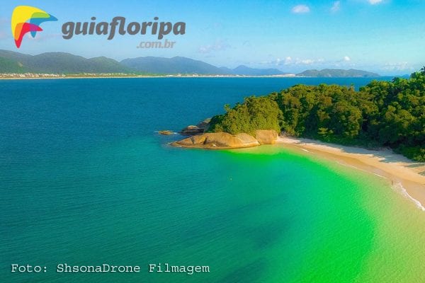
Located to the southwest of Santa Catarina Island, the Campeche Island It is 800 meters long and 300 meters wide. The highest point is Morro do Norte, with 85 meters. To the west is Praia da Enseada, sheltered from the winds, where boats can anchor.
Currently, the island is managed by IPHAN and tours depart from three points in the city. The main one is the pier in the Armacao Beach. But, you can also use the transport by boats that depart from the Campeche beach and the tour boats that leave the Barra da Lagoa. However, it is important to know that the place is a preservation area and it is not possible to camp or even light a fire.
One Island and Many Trails.
The 382 thousand square meters are cut by countless trails which, every season, are opened or closed according to the need for conservation. In the 2015 season, only 04 trails were open to visitors, organized into 05 itineraries - sign, Southern Black Stone, Stone Stuck, East Volta and North turn. To carry out the trails, for safety and comfort, it is essential that the visitor is equipped with footwear, as there are Paineira thorns on the ground.
Details
Attention: The trails are paid and can only be done with the accompaniment of an Environmental Monitor.
Difficulty level: medium.
Attractions: coatis, panoramic view, beach, Atlantic forest, boat trip, restaurant, rock inscriptions.
Time: About 7,5 hrs in total, 4,5 hrs to go up and 3 to come down Between 01h and 2h30 - Depending on the trail and the visitor's physical conditions.
Beginning and end: Enseada Beach.
Main difficulty: Some spots may be slippery from moisture.
How to get there: Boats depart daily from Praia da Armação. From Praia do Campeche and Barra da Lagoa, they vary according to the time of year.
Where sleep in the south of the island:
- Azores beach;
- Campeche beach;
- Morro das Pedras;
- Armacao Beach;
- south swamp;
- Ribeirao da Ilha;
- Tavares River;
- Solitude Beach.
who can help: Companies of Tourist Services.
Beaches Guide: Learn more about the south island beaches.
Florida Tour Guide
Discover Floripa and Region accompanied by professionals with more than 15 years of experience in the market. We set up exclusive and personalized cultural, historical and natural itineraries for you. Visits to the oyster farm, bird and whale watching, trails, rafting, free flight, boat trip, thermal tourism, cachaça and beer, shopping, Beto Carrero, shows, events, transfers and city tour through the historic center. ... [See more]
