
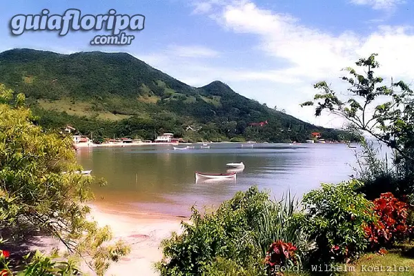
Ribeirão da Ilha - Florianópolis Beach


Região: south of the island
Subdivision: Ribeirão da Ilha neighborhood
Nearby beaches: Ribeirao da Ilha beach | Tapera Beach (5,2 km north) | Morro das Pedras beach (9,4 km east) | Shipwrecked Beach (13,6 km + 0,5 km south median trail)
Distances: Centro e Bus Station 22 km | Airport 10 km
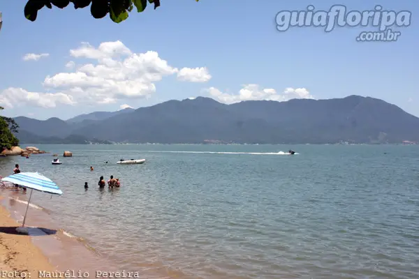
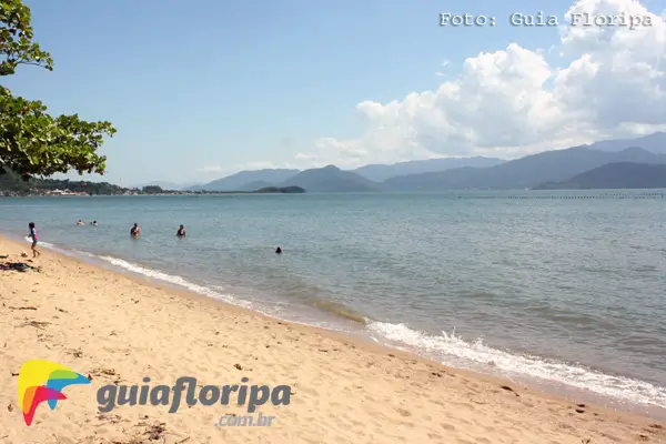
Beach Type: shallow beach (fine sand and depth slowly increases)
Curling: Calm (no waves)
Sand range: Narrow (up to 10 m)
Beach Length: 0,7 km
water temperature: Moderate
Also find: water sports, fishing, mariculture, colonial architecture, gastronomic route.

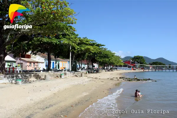
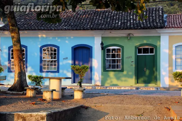
Small beaches with calm waters and coarse sand make up Praia do Ribeirão da Ilha. On the edge of the old parish center and around the church square, the architecture of the XNUMXth and XNUMXth centuries is preserved. And with the development came the expansion of the gastronomic and tourist sector.
Parish of Ribeirão da Ilha
The parish of Ribeirão da Ilha was the second district to develop during the colonial period on the island of Santa Catarina, when the neighborhood of Florianopolis downtown it was the old village of Nossa Senhora do Desterro.
The habits and traits of the culture, inherited from the Azoreans, remain alive in the oldest residents, despite urban growth. It is because of this preservation that Florianópolis is considered the tenth island of the Azores archipelago and the Ribeirão da Ilha region is a great object of study about the people who inhabited the islands of the Azores archipelago.
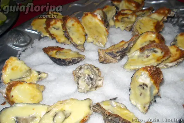
Oysters
Florianópolis is the largest producer of oysters in Brazil, with its production concentrated in the north and south bays, especially in the Ribeirão da Ilha region. Due to the cultivation of molluscs (oysters) in the waters of Ribeirão da Ilha, the gastronomic sector has developed and has become another attraction of the region. Restaurants in Ribeirão da Ilha, with a family tradition, serve excellent quality seafood. They are fresh and the dishes are plentiful, making Ribeirão a national reference in this type of cuisine.
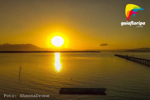
Take the opportunity to stroll along the waterfront, visit craft and bobbin lace shops. Strolling at night is also enchanting for the beauty, tranquility and friendliness of the people.
ADVERTISING

Natural Features of Ribeirão da Ilha
It is an internal beach of the South Bay. Because of this location, the sea is very calm and shallow, escaping the rule of southern beaches.
The sand is thick and dark, formed by pieces of shells. The beach is not uniform. It consists of three sections. The largest of them is in the central residential area. Ribeirão da Ilha beach starts at Riacho da Gruta and goes to Riacho do Seu Rita.
The name Ribeirão da Ilha comes from a small river that starts at Morro da Cabeça do Macaco and flows into Praia do Saco, which is about 3km from the parish. The Morro da Cabeça do Macaco is the highest hill on the island, with about 530 meters.
Adding all the stretches, the beach has 750 meters in length and width that varies between 2 and 15 meters.
History of Ribeirão da Ilha
The oldest records of human occupation in the Ribeirão da Ilha region were found in the 1960s by the priest and archaeologist João Alfredo Rohr. When sand was taken from the earth for construction, a human skeleton was discovered. At the same time, Rohr discovered an immense archaeological site in the region of Tapera Beach, very close to Ribeirão. The area would have been occupied by a Jê group (ethnicity coming from the west) and, later, by a population of Guarani tradition (coming north).
Portuguese and Azoreans
The first Portuguese and Spanish navigators who arrived in Florianópolis, arrived in Ribeirão da Ilha around 1506. Twenty years later, the browser sebastião caboto crossed the Atlantic and came to Florianópolis. It is said that it was in Porto do Ribeirão that Caboto would have anchored. Despite these early visits, it was only between 1748 and 1756 that there was the effective colonization of the Island, disembarking about six thousand Azoreans from the Portuguese colony of the Azores Archipelago.
Some authors say that fifty couples settled in Ribeirão da Ilha. The main people who contributed to colonization came from the islands of Azores archipelago (Faial, das Flores, Graciosa, Santa Maria, São Jorge, São Miguel, Pico and Terceira). Afterwards, Portuguese immigrants from Iberian Peninsula (Braga, Coimbra, Évora, Lisbon, Guimarães, Vianna, Vizeu). There are also records of Madeirans, Canaries, Spaniards, Germans and black populations, brought to work in the fields and fishing for whales.
ADVERTISING

The first period of European colonization was characterized by the predominance of economic activities such as agriculture, livestock and fishing. Azorean immigration was commanded by Manuel de Valgas Rodrigues, who founded the Parish of Nossa Senhora da Lapa do Ribeirão, close to Fort of Our Lady of Conception of Araçatuba, erected in 1742 to defend the entrance to the South Bay of Santa Catarina Island.

Tradition of Ingenuity
At first, the parish of Ribeirão produced food that was sent to troops based in the fort. In 1839, the district was promoted to a village. The area stood out for the cultivation of sugar cane, coffee and cassava, being a predominantly agricultural community. On the slopes, corn, sugarcane, beans, vegetables and watermelon were grown.
until the beginning of twentieth century there were already about 80 flour mills in the region. There was also cattle ranching on the plains.
The South Bay Sea

The relationship with the sea has always been very present in the community of Ribeirão da Ilha, being the main access route to other regions of the Island and the mainland. Overland roads were precarious. Despite this, it was only after 1950 that the fishing tradition and mariculture were formalized as the main economic activities. This was due to the decline in agricultural activities. The land was sold for the construction of houses. It was at this time that paved roads started to connect Ribeirão da Ilha to the Center, making displacement more viable and the region most targeted by new residents.
The lack of planning and the occupation of mangrove areas are characteristics of urbanization in Ribeirão. The region still suffers from problems caused by this disorderly growth.
Along with residents, bars, supermarkets, restaurants and other establishments appeared that increased tourism in Ribeirão da Ilha, which today is heavily visited for its gastronomic and historical attractions.
DISCOVER MORE South Island beaches:
- Lagoinha do Leste Beach
- Morro das Pedras beach
- Pantano do Sul beach
- Azores beach
- Armacao Beach
- Solitude Beach
- Campeche beach
- Saquinho Beach
- Matadeiro Beach
- Shipwrecked Beach
- Ribeirao da Ilha
- Taper
other regions
Looking for beaches in other regions of the island? See
Nacanoa Oyster Bar
We are a Bar and Restaurant located in Ribeirão da Ilha, specialized in serving dishes based on Oysters and Seafood. True to our roots, we recreate an intimate and welcoming atmosphere, with a breathtaking view and by the sea, with a breathtaking sunset. Our Bar has a professional Barman specialized in the preparation of drinks and cocktails, and is stocked with artisanal draft beer and a beautiful wine list. all our ... [See more]

