Shipwrecked - Florianópolis Beach


Região: south of the island
Subdivision: Ribeirão da Ilha neighborhood
Nearby beaches: Ribeirao da Ilha beach (14 km north)
Distances: Centro e Bus Station 40 km (highway) + 3 km (track or boat) | Airport 21 km + 3 km (track or boat)
Beach Type: Intermediate Beach (variable bottom, with sandbanks)
Curling: Median (with small waves) and High (from medium to large waves)
Sand range: Long (above 20 m)
Beach Length: 0,750 km
water temperature: Fria
Also find: boat ride, architecture, trail

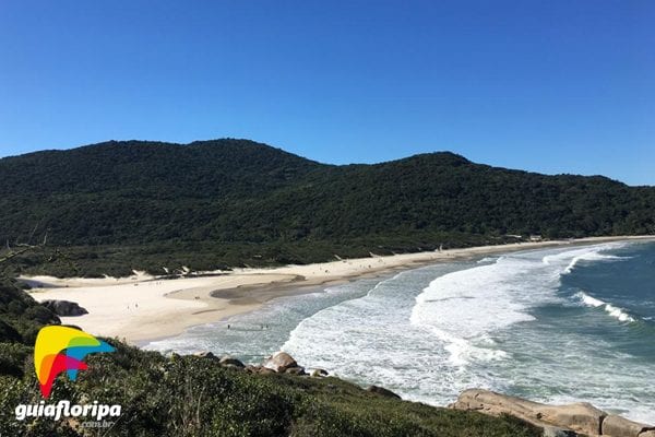
At the southern end of the island, before the sea waters take over the landscape, one last beach holds historical mysteries, ruins of buildings from other centuries and the virtually virgin nature. And the Shipwrecked Beach, where it is only possible to reach by trail or boat.
The beach has only nature and a few bars run by locals, who serve drinks and typical fishermen dishes to tourists who spend the day there. There are no cars, city noise or pollution.
The beach has white sand and waves that come straight from the ocean, being quite rough and cold most of the year. It is not a highly recommended place for children, as there are no lifeguards to provide quick assistance in emergencies.
There are few ways to get to Naufragados, but the most used is the trail that leaves Caieira da Barra do Sul. The trail starts with steep paths, but it is quite flat and with dense forest, providing shade. It takes about an hour to walk. Another option is to go by boat.
ADVERTISING
Natural Features of Naufragados Beach
The southernmost point of Santa Catarina Island is formed by a cove about 1,5 km long, open to the Atlantic Ocean, with a 750-meter strip of sand. The limits are made by rocky cliffs: the Farol Coast on the right and the Frade Coast on the left.
Some of the stones that form these natural boundaries have been named by local residents. One of them draws attention for having a smooth and rounded surface, as if it were a plate. It is not known exactly what the origin of this stone is. Some say that Indians carved it. Others claim that it is the result of the collision with the waters. There are also legends and beliefs surrounding the stone's emergence.
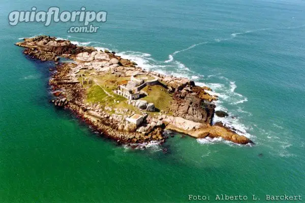
Composing the view of Praia de Naufragados are the Three Sisters IslandsThe Southern Moleks Islands and Araçatuba Island, where the Fort Nossa Senhora da Conceição de Araçatuba, in addition to Ponta dos Papagaios, in the municipality of Hut.
Praia de Naufragados is just one kilometer from the mainland. The sand is fine and white. To the right, a river flows into the ocean. Adventurers can pass through it during the trail to reach the beach.
The waters of the sea, of a dark blue color, are very fishy and can get quite violent, especially when the south wind blows. Strong and long waves are formed - on the right side especially, where you can find good conditions for surfing. The left side, in turn, has the calmer sea.
ADVERTISING

History of Shipwrecked Beach
The region was named Naufragados because it was there that survivors of a shipwreck took refuge, in addition to many bodies having been buried on the beach. A discussion revolves around which shipwreck this was. The most accepted version is from 1753, when a crew carrying 250 Azorean immigrants bound for Rio Grande do Sul to found the current city of Porto Alegre was shipwrecked in the region. In all, more than 200 people died, who had their bodies buried on the beach.
Other shipwrecks near this beach that are known to have occurred in the XNUMXth century. One of them, the ship São Miguel, commanded by Don Rodrigo de Acuna, whose destination was the Rio de la Plata, was unable to pass through the channel.
Another ship, some years before, commanded by Juan Dias Solis, ran aground nearby. Solis dubbed the region the Bay of the Lost. Peter Alexis Garcia was one of the shipwreck survivors in the south of the island. He was the first European traveler to discover the Peabiru path – which connects numerous destinations in South America, including the coast of Santa Catarina and Peru, where the Inca Empire. It was the link between the Andes and the Atlantic.
It is not by chance that, on May 14, 1883, a lighthouse was inaugurated on the site, reaching up to 42,6 meters in height, to assist the vessels that passed by. In the XNUMXth century, a fortress was built by Brigadier Jose da Silva Paes on the island of Araçatuba, right in front of Praia de Naufragados. It was part of the island's defense system.
This island was the scene of a remarkable episode in the history of southern Brazil. During the Farroupilha Revolution, in 1839, soldiers who served in the Fortress joined the rebels. They kidnapped the commander of the fort, Ensign Peter Fernandes, and took him to Laguna to be executed. The rebels were eventually arrested.
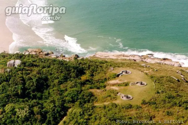
During the Second World War, some cannons for military training were installed at Praia de Naufragados. They used as a target some rafts thrown overboard and sometimes the walls of the fortress itself.
DISCOVER MORE South Island beaches:
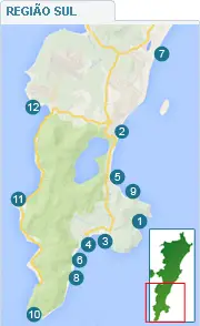
- Lagoinha do Leste Beach
- Morro das Pedras beach
- Pantano do Sul beach
- Azores beach
- Armacao Beach
- Solitude Beach
- Campeche beach
- Saquinho Beach
- Matadeiro Beach
- Shipwrecked Beach
- Ribeirao da Ilha
- Taper
other regions
Looking for beaches in other regions of the island? See
