Agronomics - Florianópolis Neighborhood
Região: Central Region of the Island
Close quarters: Centro (4,8 km) | Trinity (5 km)
Nearby beaches: Conceição Lagoon (12 km east) | soft beach (15 km east) | Joaquina Beach (16 km east) | Cacupe beach (12 km north) | Campeche beach (17,4 km south)
Distances: Centro e Bus Station 4,8 km | Airport 20 km
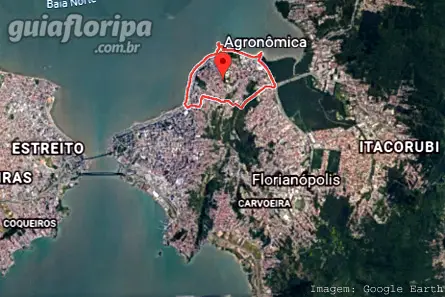
 | The Agronomic neighborhood is a traditional residential neighborhood in Florianópolis. It is located in Central region da city, at the northern end of the Massif Morro da Cruz, between the Florianopolis downtown and the Trindade neighborhood. One of its limits is Rua Allan Kardec, which separates it from the Center. On the other hand, the kneecap of the penitentiary separates him from the Trinity. |
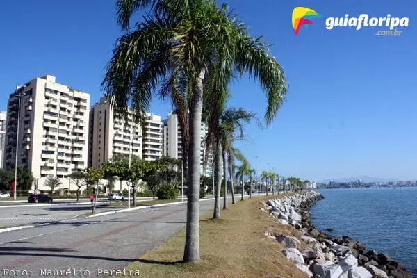
It is a predominantly residential area, with noble areas, mainly on the edge of the city's main avenue, the Avenida Beira Mar Norte, which crosses the neighborhood, between the squares Governor Celso Ramos and Professor Seixas Neto. Commerce is small, with a few options for bakeries and pharmacies. However, on Avenida Beira Mar, there is a good point of sale for regional produce. Further on, almost in Trindade, is one of the largest supermarkets in the region.
It is in the Agronomic neighborhood that two of the main state hospitals are located, the Joan of Gusmao, a reference in child care, and the Nereu Ramos, with services of high and medium complexity. The neighborhood is also home to many public bodies, such as the Federal Justice, the Federal Police, the Public Ministry, the OAB and the Casa d'Agronomica, the official residence of the governor of the State of Santa Catarina.
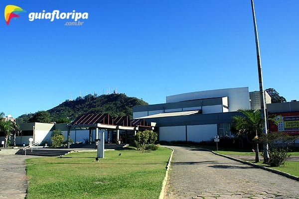
Further on, on the border with the Trindade neighborhood, we find the Florianópolis Penitentiary and the Integrated Culture Center, better known as CIC, which integrates music, dance, cinema, plastic arts and architecture, among other cultural activities. Inside the complex, there are important spaces such as the Santa Catarina Art Museum (MASC), the Ademir Rosa Theater: Lindolf Bell Space: Museum of Image and Sound (MIS) and the Cineclube Nossa Senhora do Desterro, in addition to the Santa Catarina Symphony Orchestra and the Catarina Academy of Letters (ACL).
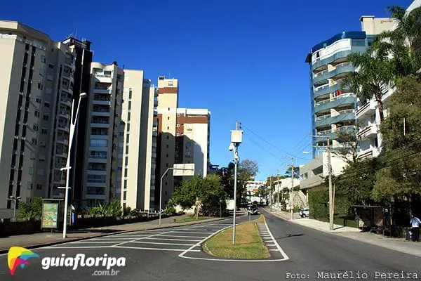
This region has been the target of real estate speculation, with the construction of several commercial and residential buildings.
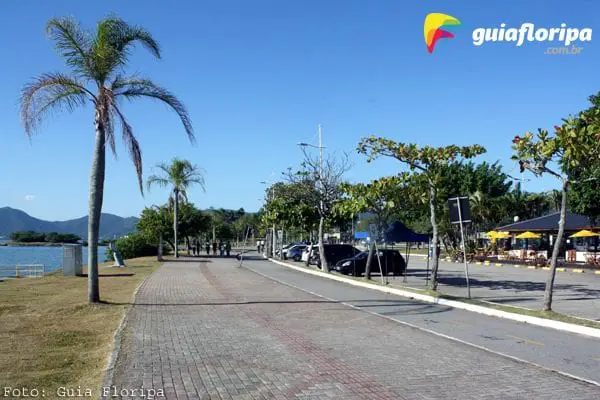
Agronomics is also very rich in public leisure spaces. The main one is the edge of Avenida Beira Mar Norte, with a bike path, a huge boardwalk with outdoor gyms, benches and kiosks. right in front of Ponta do Coral the headquarters of the Catarinense Tennis Federation is located, with its courts and a school for learning the sport. Next door, on the waterfront, is the famous bar Koxixo's, the city's meeting point when the subjects are the celebrations of sports titles or political claims.
On the border between the neighborhood and the Center there is a shopping center, the Beiramar Shopping, and two hotels, the majestic palace and the Blue Tree Florianopolis.
Where to stay in the Agronomic neighborhood? See options on the map below:
History
According to Virgílio Várzea, one of the most important writers born in Florianópolis, the region that today corresponds to the Agronomic neighborhood was known by other names, such as Pedra Grande and São Luís, having been initially formed by farms with gardens and small farms, mainly , vegetables and pasture for the creation of Creole cattle.
ADVERTISING
The region grew slowly, starting from the current stretch that goes from Praça Lauro Müller, on the corner of Mauro Ramos and Beira Mar Norte avenues, to Rua Embaixador Edmundo da Luz Pinto, at the end of Praça Governador Celso Ramos. This region was called São Luís, because from 1771 onwards, the Fort São Luís, one of the fortifications devised by the Brigadier Silva Paes to protect Santa Catarina Island, demolished in the XNUMXth century. (Look more about the fortification system of Santa Catarina Island)
Interestingly, there is another version for the use of the name São Luís. It seems that in that region, on the edge of the beach, there was a stone with a mark, as if carved in its relief, which resembled the shape of a human foot. The inhabitants of the region, at the time, believed that it was the mark of the "Pé de São Luís de Gonzaga", left on the stone when the saint appeared on it.
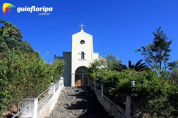
The other part of the neighborhood, which goes from Praça Celso Ramos to the Penitentiary of Florianópolis, was known as Pedra Grande, having received this name because of a large stone, oval in shape, that existed next to the beach until the 1970s. , when it was imploded during the grounding works in the region.
It was only at the beginning of the 1904th century that the area became known as Agronomic, because in XNUMX, the Agronomic and Veterinary Station, a research unit that existed in Rio dos Cedros, was transferred to Florianópolis, establishing itself in the nearby region. to Ponta do Recife, currently called Ponta do Coral. This unit was called the Pedra Grande Agronomic Station and its main objective was to improve the island's bovine population.
In 1926, under the government of Adolfo Konder, the Pedra Grande Penitentiary was inaugurated, on the border between the current districts of Agronomica and Trindade. The arrival of the families of the convicts intensified the disorderly occupation of the slopes of the Maciço do Morro da Cruz, favoring the creation of poor communities such as those on the Penitenciária and Horácio hills.
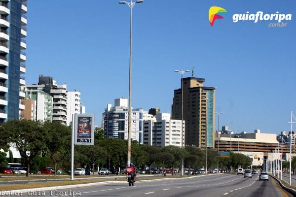
Later, from the 1950s, the Federal, State and Municipal powers intensified the occupation of the region, with the inauguration, in 1954, of the Governor's residence, currently Casa d'Agronomica, and the dependencies of the 5th Naval District. But it was from the mid-1960s onwards that the region received its greatest modernizing impulse, with the construction of Avenida Beira Mar Norte, the Joana de Gusmão Children's Hospital and the Integrated Culture Center (CIC).
DISCOVER MORE Neighborhoods in the Central Region from Florianopolis
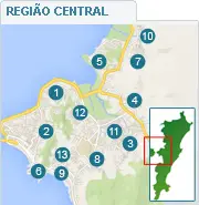
- agronomic
- Centro
- Big Stream
- Itacorubi
- John Paul
- Jose Mendes
- Monte Verde
- Pantanal
- Bag of Lemons
- Big bag
- Santa Monica
- Trinity
- Bunker


