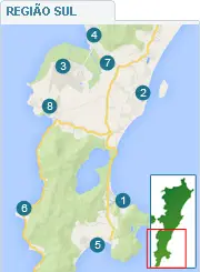
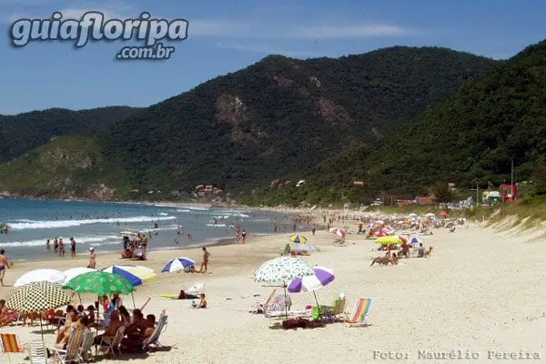
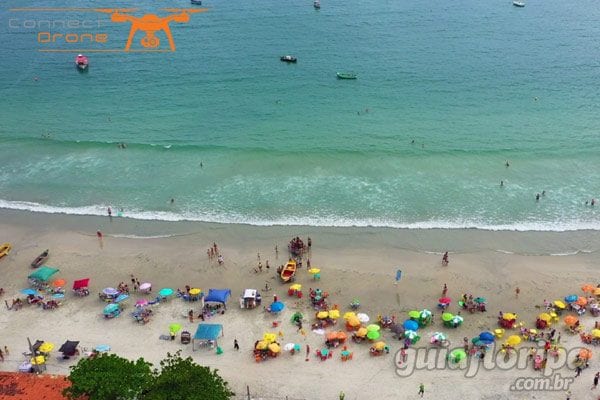
Pântano do Sul - Florianópolis neighborhood


Região: south of the island
Close quarters: South Swamp Frame (8,5 km)
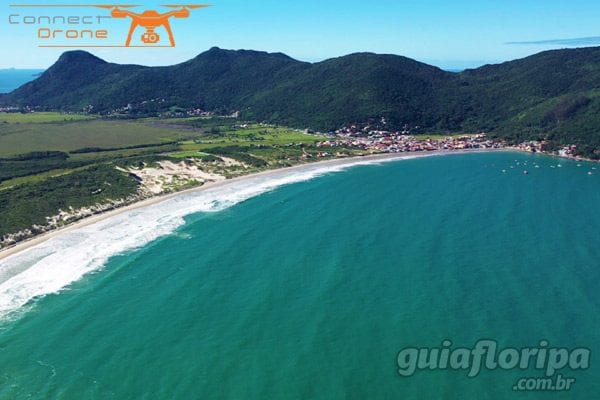
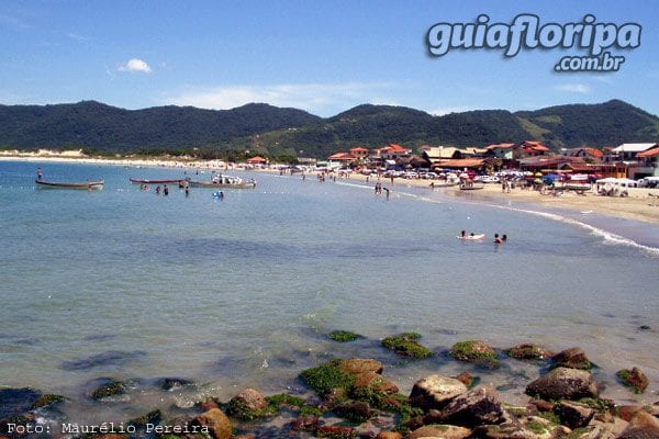
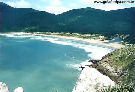
Nearby beaches: Pantano do Sul beach | Azores beach (south)| Lagoinha do Leste Beach (east)
Distances: Centro e Bus Station 26 km | Airport 16,8 km
Also find: boat trips, fishing, surf, trail, "foot-in-the-sand" restaurants

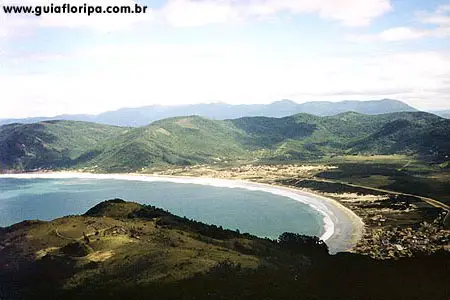
O south swamp neighborhood is one of the most isolated and traditional neighborhoods in Florianópolis. It is located in the extreme south of the southeastern portion of Santa Catarina Island, 26 kilometers from the downtown florianopolis, after the neighborhoods of Tavares River, Campeche and South Swamp Frame.
Its area occupies 47,68 km². It ranges from the beaches of Lagoinha do Este, from the azores, of Solitude, from the bag and the very south swamp beach, to inland towns such as Costa de Dentro, Costa de Cima and Sertão do Peri.
large expanse of land
Despite occupying a large area of land in the south of the island, approximately 2.528 people live in the neighborhood. They are divided into small nuclei, such as the central nucleus, located by the sea, where the houses of the oldest families in the region are located.
The other nuclei are located on the hillside of the Municipal Park of Lagoinha do Este and along Highway SC-406, at the entrance to the valley, in the locality known as Costa de Cima, in the subdivision of Azores beach and at the west end of the shore, in the Solitude Beach and on the Inland Coast.
Even with the urban growth suffered in the last decade, the community of Pântano do Sul still preserves the islander accent and traditions based on the azorean culture. It is in this region that one of the most famous typical food restaurants on the island is located, the plow, known for having messages from visitors from all over the world hanging on its walls.
Urban infrastructure
The neighborhood offers a reasonable urban infrastructure, with most of its streets paved and without buildings. The region is served by five bus lines from the Insular company, two of which are executive (4120, 4127) and three regular (562,563 and 564). There is a Health Center and an Educational Center (NEI).
the means of lodging are restricted to some inns and hostels. Commerce is limited, basically focused on the needs of its residents, with markets, bakeries and pharmacies. Entertainment options are sparse, with some bars offering live music during the summer season.
ADVERTISING

History
The name of the Pântano do Sul neighborhood was borrowed from the praia of the same designation. According to stories that circulate among the residents, the western portion of this beach consisted of small rivers coming from the surrounding hills. This made the ground look like a swamp. This peculiar configuration allowed the development of irrigated rice cultivation, a practice that was maintained for many years.
It is in the Pântano do Sul that the oldest archaeological records of Santa Catarina Island are located. O sambaqui existing in the neighborhood was dated to approximately 4.500 years. It is formed by a large deposit of shells, remains of artifacts used in everyday life and sets of bones. They were piled up over time by some of the first human groups to inhabit this part of the coast.
Immigrants from Ribeirão da Ilha
The definitive occupation of the Pântano do Sul began in the XNUMXth century, but only intensified in the following hundred years. A small group of families from the parish of Ribeirao da Ilha settled in the region. It gave rise to a very peculiar village in geographical terms. Unlike other locations, which grew from their churches, Pântano do Sul developed along the paths that connected it to the rest of the Island.
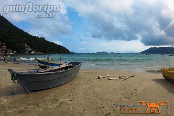
A significant portion of the Pântano do Sul land was for collective use. Everyone could use them for farming, raising animals and extracting wood for building houses and domestic use. However, the soil eventually proved to be quite unfavorable to agricultural practices. As a result, the residents preferred the fishery as the main livelihood activity.
ADVERTISING
Azores beach
In the mid-twentieth century, practically all areas of common use existing in Florianópolis underwent appropriation processes, turning them into spaces for private use. Due to the poverty of the soil, the communal lands of Pântano do Sul were eventually subdivided. This enabled the construction of large condominiums present in the neighborhood today, such as the Azores beach.
From the 1960s onwards, the landscape of the capital of Santa Catarina began to change significantly due to a major urban reform. It is at this time that Pântano do Sul is officially disconnected from Ribeirão da Ilha and becomes the seat of a new district. In the 1970s, the construction of the SC-405 highway connects the south of the island to the center of Florianópolis and inserts the neighborhood into the city's development route.
Since then, tourists have discovered the beauties of Pântano do Sul. A significant number of the residents of the neighborhood saw in this segment a new economic potential for the locality. Several began offering their homes for rent during the summer season, some built inns and others invested in restaurants or shops. This mix of natural beauty and hospitality eventually attracted new residents to the area as well.
Learn more about Pantano do Sul beach.
ADIEX
DISCOVER MORE Neighborhoods in the South Region of Florianópolis